
Resultados de la búsqueda
Para más opciones de búsqueda, vea Ayuda:Búsqueda.
Si consideras que este artículo debería existir, conoces nuestros pilares, dispones de fuentes fiables y sabes indicarlas como referencias, puedes crearlo, opcionalmente usando nuestro asistente.
- Cartographer, y luego pasó a llamarse en 1990 Cartography and Geographic Information Systems, para en 1999 recibir su actual nombre.[3] La revista está…2 kB (172 palabras) - 11:25 24 may 2023
- (GNS)». Consultado el 28 de diciembre de 2015. MIT (ed.). «Geographic Information Systems (GIS): General Data for the world». Consultado el 28 de diciembre…2 kB (220 palabras) - 00:17 10 jul 2021
- biodiversity of Nallıhan (A3-Ankara) forest ecosystem by means of geographic information systems and remote sensing. Ed. Metu. 164 pp. La abreviatura «Doğan…2 kB (184 palabras) - 17:43 4 ene 2024
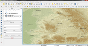 Information Systems. Prentice Hall. 3rd edition. Longley, P.A., Goodchild, M.F., Maguire, D.J. and Rhind, D.W. (2005) Geographic Information Systems and…94 kB (9954 palabras) - 15:28 23 ene 2024
- of Geographic Information Science (en inglés). CRC Press. p. 4. ISBN 9780203009543. Goodchild, Michael F. (2009). «Geographic information systems and…9 kB (1054 palabras) - 05:26 5 oct 2023
 Virginia Chamber of Commerce Washington County Virginia GIS (Geographic Information Systems) Mount Rogers Planning District Barter Theater (State Theater…4 kB (312 palabras) - 16:55 9 ene 2024
 inglés) Sociedad histórica de Colorado. (en inglés) Pueblo County Geographic Information Systems website Datos: Q312731 Multimedia: Pueblo County, Colorado /…4 kB (340 palabras) - 20:06 15 ene 2024
 Esri (redirección desde Enviromental Systems Research Institute)Esri (Environmental Systems Research Institute) es una empresa fundada por Jack Dangermond en 1969 que en sus inicios se dedicaba a trabajos de consultoría…2 kB (143 palabras) - 18:05 16 ene 2024
 marzo de 2021. Goodchild, Michael F. (1 de julio de 2016). «Geographic information systems:». Progress in Human Geography (en inglés). doi:10.1177/030913259101500205…3 kB (237 palabras) - 18:17 29 sep 2023
- Small-scale map projection design. Research monographs in geographic information systems. London: Taylor & Francis. p. 291. ISBN 9780203472095. Mulcahy…30 kB (3342 palabras) - 09:40 19 abr 2024
- «Basic Mapping Principles for Visualizing Cancer Data Using Geographic Information Systems (GIS)», American Journal of Preventive Medicine (?) 30: S25-S36…10 kB (1045 palabras) - 01:15 14 abr 2024
 septiembre de 2019. «District map» (en inglés). The Centre for Geographic Information Systems of Qatar. Archivado desde el original el 24 de noviembre de…4 kB (434 palabras) - 00:01 10 nov 2023
 _stats#by_number_of_edits Geographic Information Systems: Concepts, Methodologies, Tools, and Applications. USA: Information Resources Management Association…6 kB (584 palabras) - 15:04 4 abr 2024
- using a Historical Geographic Information System (Historical GIS) Historia-GIS Mailing Lista Historical Geographic Information Systems Online Forum on Google…10 kB (1301 palabras) - 05:36 14 abr 2024
 Claudia Maria Bauzer (19 de septiembre de 2009). ADVANCED GEOGRAPHIC INFORMATION SYSTEMS -Volume I (en inglés). EOLSS Publications. ISBN 978-1-905839-91-9…7 kB (873 palabras) - 23:44 20 abr 2024
- bioenergy in the province of Mendoza-Bio-fuels and biomass-Using geographic information systems". International Journal of hydrogen energy 35 : 5766–5771 resumen…7 kB (554 palabras) - 07:08 1 mar 2024
- con la Oficina de Censo Nacional. Con siglas en inglés: GIS, Geographic Information Systems The Israeli Spatial data infrastructure. ISPRS 2010 at: http://www…14 kB (701 palabras) - 20:04 18 sep 2023
 noviembre de 2017. Yonzon, Pralad; Jones, Royce; Fox, Fox (1991). «Geographic information systems for assessing habitat and estimating population of red pandas…7 kB (650 palabras) - 09:52 4 feb 2021
- Residential Land Analysis] within the developmental trajectory of Geographic Information Systems (GIS)." 2013, Robert Holton, "Natalie De Blois - - The role…12 kB (1202 palabras) - 07:36 7 ago 2023
- gráfica Análisis exploratorio de datos Exploratory data analysis Geographic information science Geoinformática Retoque fotográfico Procesamiento de señales…5 kB (679 palabras) - 20:24 12 abr 2024


- tales como el Spatial Data Transfer Standard (SDTS) y Digital Geographic Information Exchange Standard (DIGEST). El poder del software SIG proviene no